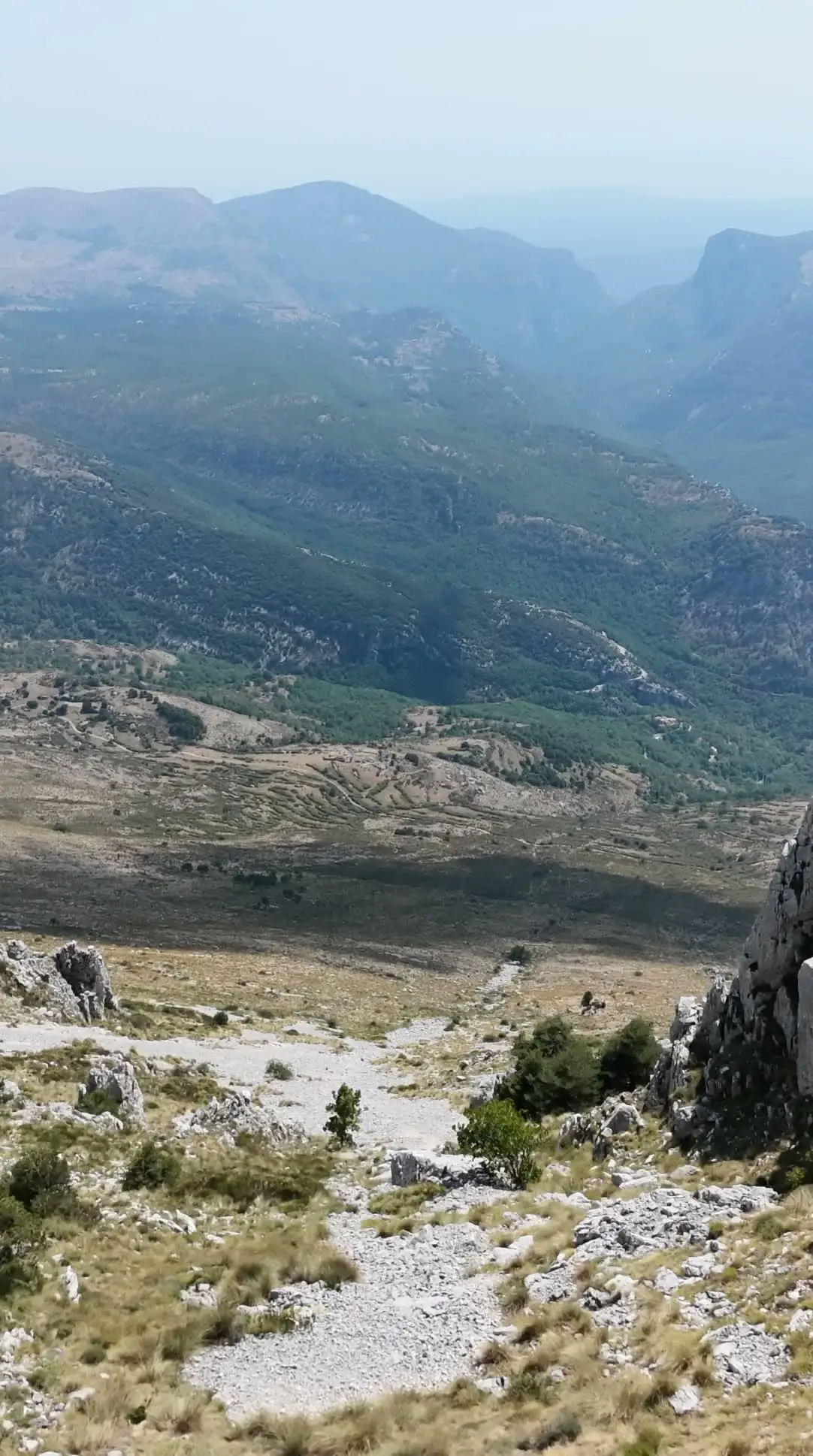
Gréolières-les-Neiges has something very few ski resorts can claim: perched between 1,400 and 1,800 m on the Cheiron massif, it sits just 21 km from the sea as the crow flies. It is the closest resort to the French Riviera coastline, and on a clear day you can swing your eyes from pine trees to the Mediterranean in a single glance.
This guide runs through the panoramas you should not miss, from the highest summit in the Préalpes d’Azur to the viewpoints you pass on the way back down to the coast. For each one you will find what you can see, how to get there and when the light is at its best.
Why can you see the sea from Gréolières?
The answer is geography. The Cheiron massif forms a long east-west ridge, standing in the front line above the coastal plain with no other major relief to screen it from the Mediterranean. The result: from the ridge, your gaze drops nearly 1,800 m of vertical all the way to the sea, while to the north the high summits of the Mercantour unfold.
This balcony position also explains how accessible the resort is: Nice is 62 km away, Cannes 59 km, Grasse 46 km — roughly an hour’s drive. So you can quite reasonably have breakfast facing the sea and lunch at 1,700 m.
The Cime du Cheiron (1,778 m): the king of viewpoints
This is the highest point in the Préalpes d’Azur, and the most complete panorama in the area. Three orientation tables are installed at the summit: they help you put a name to every line on the horizon, which is no luxury given how wide the sweep is.
What you can see from the summit
- To the south, the coastline from Saint-Tropez to Monaco, with Cap d’Antibes and the Baie des Anges clearly picked out.
- To the north, the wall of the Mercantour, all the way to the Cime du Gélas (3,143 m), often snow-covered into early summer.
- On exceptionally clear days, Corsica appears as a silhouette out to sea — a privilege reserved for a handful of mornings a year, usually after a windy spell has scrubbed the air clean.
How to get up there
The classic route starts from the Collet car park, at the resort, and follows the GR4: allow 8.4 km round trip, +504 m of ascent and around 4 hours of walking, at a moderate level. The path first crosses pine woods, then emerges onto drier ridges dotted with lavender.
In summer, the Huskies chairlift cuts the climb down considerably: a good option with children, or when you want to save energy for lingering at the top.
Look up regularly: the area is frequented by the short-toed snake eagle and the griffon vulture, and you will often meet flocks on the summit grasslands. For route details and longer variants, see our guide to hiking from Gréolières.
The Croix de Verse (1,706 m): the 360° panorama
Set on the Cheiron ridge, the Croix de Verse offers a full sweep of the horizon: the coastline on one side, the inland valleys and the Mercantour on the other. You reach it on the ridge route, and it makes a very sensible objective when you want a big panorama without going all the way to the summit.
The advantage of the ridge is that it gives the landscape depth: you walk along a dividing line, with two different worlds on either side. The drawback is exposure — to wind, to sun and, in a storm, to lightning. Check the mountain forecast the evening before and again in the morning, and have a plan B if instability is forecast for the afternoon.
The Croix de Barri (1,350 m): the village balcony
Less well known, the Croix de Barri overlooks the village of Gréolières and gives a plunging view over the Loup valley and the village of Cipières. It makes an excellent half-day objective: less altitude, less commitment, but a very telling viewpoint on how the landscape is organised, with terraced fields, dry-stone walls and hilltop villages.
The resort road: a viewpoint on wheels
The climb from the village follows the RD2 to the Plan du Peyron, then the RD802 up to the resort. It deserves some time: the hilltop village first appears below you, then the road rises above the Loup valley, and the final hairpins open up glimpses of the sea.
A few common-sense pointers:
- Stop only in the designated pull-offs, never on a bend.
- The road is narrow in places: anticipate oncoming traffic, especially at busy times.
- In winter, snow equipment is recommended; check road conditions before setting off.
- On arrival, the free 2,800-space car park at the foot of the slopes settles the parking question.
The hilltop village of Gréolières (830 m)
Clinging to the south face of the Cheiron, the old village is a viewpoint in itself, facing due south over the Loup valley. It is also a striking contrast with the resort: less than 20 minutes’ drive apart, you move from mountain atmosphere to Provençal atmosphere, with narrow lanes and warm-toned facades. A good stop for a coffee or a meal — see our suggestions on where to eat in Gréolières.
On the way to the sea: Gorges du Loup and Col de Vence
If you are heading back down to the coast, two detours are well worth the extra miles.
The Gorges du Loup
Viewpoints line the RD6 as it follows the gorge, with the Cascade de Courmes and the Saut du Loup (paid viewpoint) as the highlights. Water, rock and vegetation create a setting completely unlike the ridges: the perfect counterpoint to a morning at altitude. Thrill-seekers will find plenty here too, as our article on canyoning in the Gorges du Loup explains.
The Col de Vence (963 m)
The pass offers an open view over the sea, from Nice to Cap d’Antibes, in the middle of a typically mineral landscape: the baous, those limestone plateaus with abrupt cliffs, including the Baou des Blancs and the Baou des Noirs. Late in the day, the low raking light here is particularly beautiful.
When to go: seasons and light
The panorama changes completely depending on the moment:
- Spring (April to June): the air is often the clearest of the year, snow still holds on the Mercantour and the meadows are in flower. This is the best period if you hope to see a long way.
- Summer: set off early. Heat and humidity create a haze that closes the horizon down by midday, and storms readily build in the afternoon.
- Autumn: golden light, clear air again, few people. A very underrated season on the Cheiron.
- Winter: the cold, windy days that follow a mistral episode offer the most spectacular visibility.
As a general rule, the first two hours after sunrise and the hour before sunset give the best results: the relief takes shape, the coastline stands out, and backlighting is far less overwhelming than at midday.
Reaching the viewpoints in winter: snowshoe routes
When snow covers the massif, the same viewpoints can be reached on snowshoes. Three objectives, in order of commitment:
- Boucle Ouest des Pivoines (west peony loop): around 1 hr 30, ideal for a first outing or with children.
- Croix de Verse: around 3 hrs 30, for walkers who are comfortable on snow.
- Cime du Cheiron: around 7 hours, a genuine winter mountain day.
In winter, a few habits are essential: set off early (darkness comes quickly), carry a head torch, warm and windproof clothing, lukewarm rather than ice-cold water, and tell someone your route. Wind on the ridges drives the wind-chill down far faster than you would imagine.
Preparing your panorama outing with Bogho Sports
Whether you go up on foot, on snowshoes or by electric mountain bike — the fastest way to reach the ridge in summer — equipment makes the difference between a great day out and a day you simply endure.
Our shop is at 310 Traverse du Cheiron, at the foot of the slopes, open 7 days a week from 9am to 5pm. We rent snowshoes at €11 a day and electric mountain bikes at €40 per half-day, €60 per day; take a look at electric mountain bike rental or ski and snowboard rental depending on the season.
And if you are unsure about the route or the conditions on the day, just ask: call +33 6 21 45 80 87 or go through the contact page. We know the mountain above our heads, and we will tell you straight whether today is the day to hope for Corsica.